Yunnan province is famous for its mountains, that are very close to Tibet, and Tiger Leaping Gorge, where we were about to start our 2-day hike, is one of the deepest gorges in the world.
The hike's starting point was about 2 hours away by bus from Lijiang and we arranged the transfer with our guest house the day before. Once in the bus, we saw that almost all the passengers were about to go on a hike, just like us.
It was a hot sunny day, great for the photos, bad for walking...
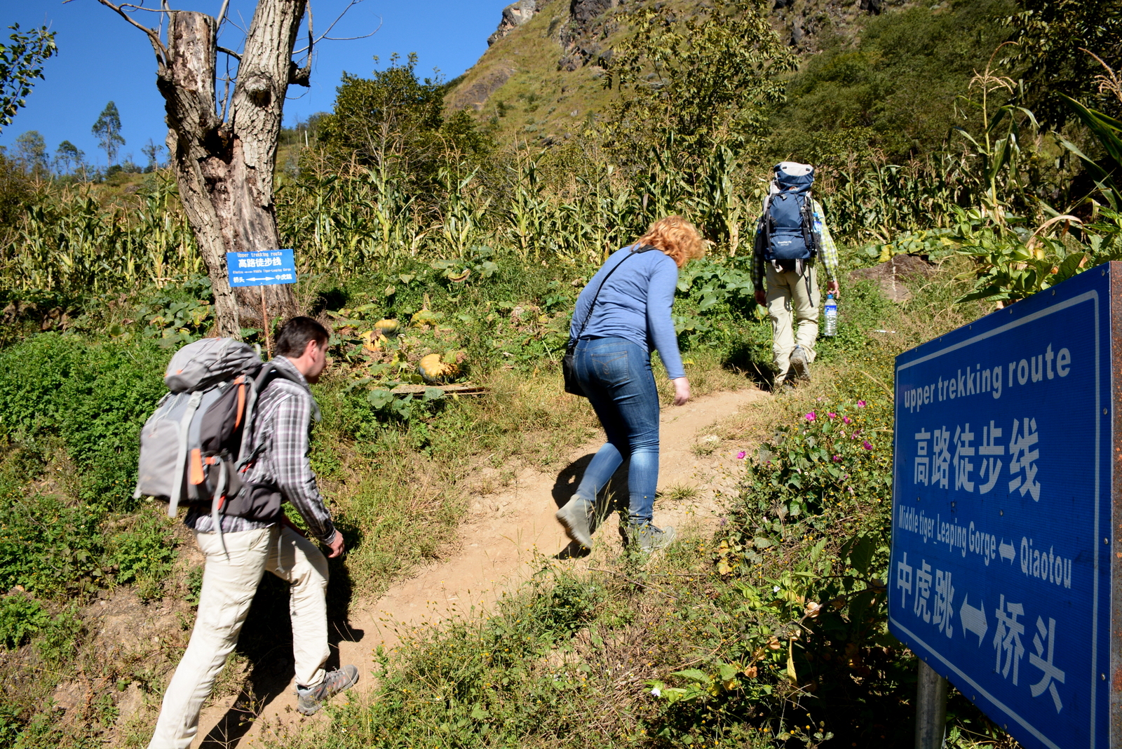
The hike is about 30 km long, and is mostly done in 2 days, in some cases 3. The first part is the most difficult one with a continuous clime of over 5 hours.
Part of the route was closed due to construction work and we had to begin with a steep climb much earlier than we had to.
Unfortunately, Dima was feeling sick since the day before and I also had difficulty breathing properly, because of the altitude.
It was getting hotter and hotter by the minute and we were trying to keep the hydration levels in order.
At some point on the way up, Dima started to feel from bad to worth and Oleg even took his backpack to carry up.
However, it didn't help. So we decided, that Dima and I will go back to the starting point and see if we can catch a ride to the first guesthouse just after the 28 bends (the most steep climb, after which the hike becomes reasonably leveled). We heard from another couple of hikers a day before, that such option exists.
When we got back to the road, the first locals we met were able to help us. They called someone and arranged for them to take us all the way up. While we were waiting, Dima found the whole cannabis plantation. We were even offered some, but we politely refused)))
About 40 minutes later a minivan came to pick us up. The road along the cliffs was quite scary, with lots of construction work on it. Sometimes, we were so close to the end of the cliff that we could see the river below.
There are just a few places on the road that have the safety fence, but the largest part still misses it.
Luckily, the most dangerous parts were taken care of first.
It took about another 40 minutes to get to the guesthouse where we started to wait for Oleg and Lena to get there on foot.
The view here is absolutely gorgeous!
While waiting, we met a Dutch couple that started at 8 am and they got up in 5,5 hours, so we figured that the guys will get to us at around 15:30, which would give us plenty of time to walk the halfway of the hike before dark.
Most of the hikers are European, South Korean and Japanese. While the Europeans hike alone or with 2-4 people, the Korean and the Japanese always hike in large groups. It's really funny, the way they stay together no matter what. And of course the group picture everywhere is compulsory))
The guys showed up at exactly 15:30, just as we calculated, and after getting some food we went to finish the first day hike, by hiking another 2,5 hours to the halfway point.
For the night, we stayed in one of the guesthouses at the halfway point. We were chatting to others till it got dark and then went to sleep, because we still had another 3-4 hours of hike the next day.
In the morning we left at 8. It was nicer to hike because the air was still cold and it felt nicer.
Trying to pass the Korean group on the way down. It's strange, but they don't let you pass unless you specifically ask to, even if they are aware that you are faster.
Not sure, but I think these are the edelweiss flowers.
Tired but happy))
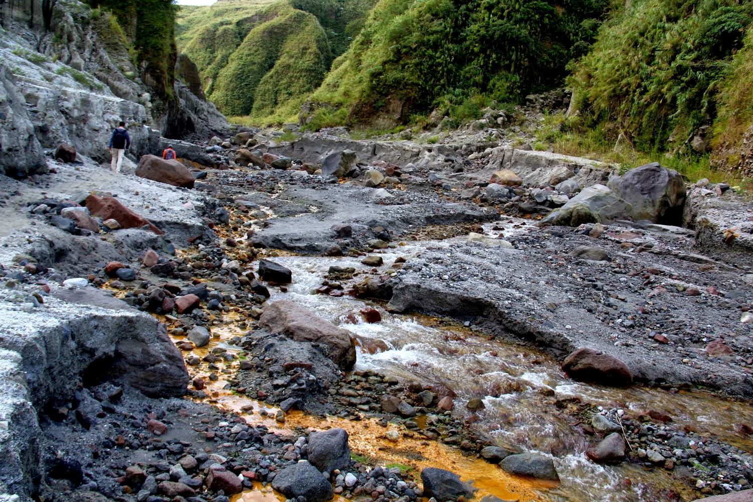
At some point me left feet started to heart a lot, so Dima and I slowed down a bit, but the guy went ahead, because they still wanted to do as side hike all the way down to the river.
By the time we got down, they already had lunch and started walking down, while we stayed with the backpacks.
These are Lena's pics from the hike to the river.
The meal of the hike became this fantastic dish. We saw a couple of locals eating it and from a distance we thought it was potatoes with meat and gravy. It turned out to be fried pork fat in melted fat. None of us dared to try it.))
After the hike we spent a couple of more hours at Tina's guesthouse, from which we took a bus to Shangri-la, a town high in the mountains, on the border with Tibet.
Next: Shangrila,Tibetan monastery and Shuhe village